
The roadway infrastructure in Fayetteville, Arkansas, must contend with the region's complex geological setting within the Springfield Plateau of the Ozark Mountains. This area is characterized by interbedded limestone and shale, with significant variations in bedrock depth, karst features such as sinkholes, and steep slopes that pose challenges for cut-and-fill operations. Seasonal rainfall and expansive clay soils further complicate subgrade stability, often leading to differential settlement and longitudinal cracking if not properly addressed. Technical context demands rigorous geotechnical investigations to delineate soil profiles, evaluate slope stability, and assess groundwater conditions. Understanding the site-specific stratigraphy is essential for designing pavements that can accommodate both static loads and dynamic traffic stresses, particularly on arterial routes like Razorback Road and Martin Luther King Jr. Boulevard.
Standardized testing methods are critical for characterizing roadway materials in Fayetteville. Soil classification follows ASTM D2487 (Unified Soil Classification System), while compaction control adheres to ASTM D698 (Standard Proctor) or ASTM D1557 (Modified Proctor) depending on design requirements. In-situ evaluation of subgrade strength is performed via the California Bearing Ratio (CBR) per ASTM D1883, which guides pavement thickness design. Locally, the Arkansas Department of Transportation (ARDOT) mandates specific acceptance criteria for base course aggregates and hot-mix asphalt, often referencing Arkansas Test Method (ATM) procedures for moisture-density relationships and resilient modulus. ISO standards such as ISO 17025 are applied to ensure laboratory competency, while field verification of compaction uses nuclear density gauges calibrated to local soil types.
Applicable standards and specifications for roadways in Fayetteville derive primarily from the AASHTO Guide for Design of Pavement Structures, supplemented by ARDOT's Standard Specifications for Highway Construction. City of Fayetteville engineering requirements incorporate these state-level standards, with additional provisions for stormwater management and erosion control per NPDES permit guidelines. Drainage design follows the Arkansas Drainage Manual and local hydrologic studies, employing Rational Method or SCS curve number techniques. Environmental compliance is ensured through Fayetteville's Green Infrastructure standards, often necessitating permeable pavement sections. Furthermore, ADA accessibility standards set within the Americans with Disabilities Act dictate curb ramp configurations and cross-slope tolerances that must be integrated into roadway geometry, particularly for pedestrian-heavy corridors near the University of Arkansas campus.
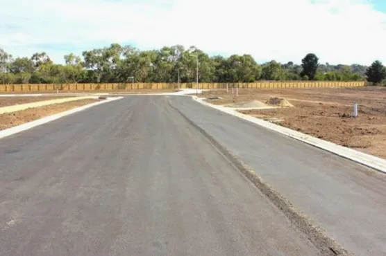
Typical roadway applications in Fayetteville include arterial widening projects on College Avenue (US 71B) to improve capacity and safety, as well as residential street reconstruction in older subdivisions where subgrade failures have occurred. Intersection improvements at steep-grade locations, such as the junction of Garland Avenue and Maple Street, often require retaining walls or mechanically stabilized earth (MSE) systems to manage cut slopes. Another common application is the use of full-depth reclamation (FDR) for rehabilitating failed pavements on collector roads, where existing asphalt and base are pulverized, blended with stabilizing agents like lime or cement, and recompacted. For new subdivisions in hilly western Fayetteville, roadways are designed with reinforced subgrades using geogrids to mitigate differential movement over variable bedrock.
Several typical cases illustrate the geotechnical challenges observed in Fayetteville roadways. On Mount Sequoyah, a steep residential hill, pavement distress was traced to shallow bedrock combined with inadequate drainage, leading to subgrade softening and edge cracking. Mitigation involved installing underdrains and replacing the affected subgrade with select granular material. Another case involved a segment of Porter Road where embankment failures occurred after heavy rains; subsequent investigation revealed weak clay layers beneath fill. The remediation employed lightweight fill and slope flattening. In low-lying areas near the West Fork of the White River, expansive soils required pre-construction lime stabilization to reduce swell potential, monitored via ASTM D4546. These cases underscore the necessity for site-specific evaluation rather than generic design assumptions in Fayetteville's variable geology.
For successful roadway projects in Fayetteville, it is recommended to begin with a comprehensive subsurface exploration program, including borings to bedrock depth, test pits for karst feature identification, and groundwater monitoring. Drainage design must account for both surface runoff control and subsurface interception of spring flows. Use of local limestone aggregates for base layers is advised, but their sulfidic potential should be tested to avoid long-term sulfate attack. Stabilization of problematic subgrades using lime or cement should follow ARDOT mix design protocols and be verified with unconfined compressive strength tests. Additionally, adopting performance-based specifications for compaction and strength acceptance can reduce variability. Finally, coordination with city planners regarding utility conflicts and future capacity needs will ensure roadway longevity and cost-effectiveness over the design life.
This service complements our laboratory testing work for a complete project analysis.